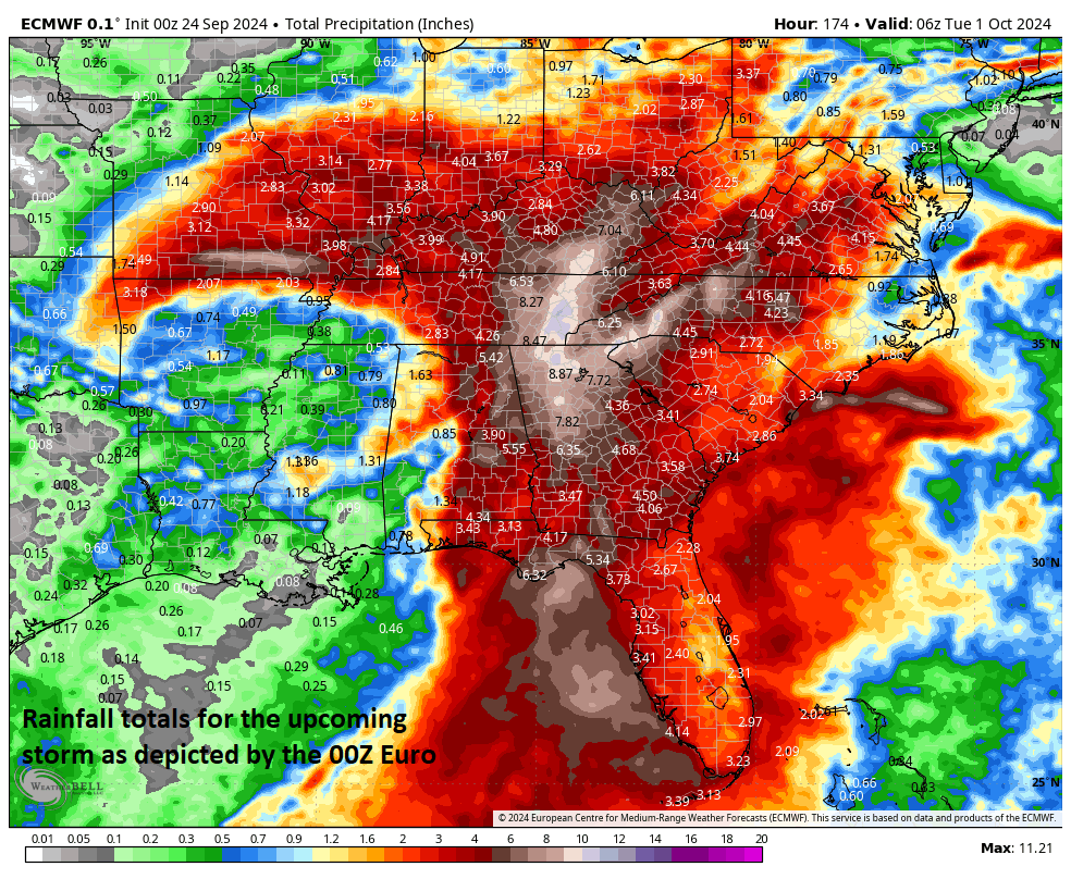

The possibility exists for powerful wind gusts across Georgia during this upcoming storm event as well as significant rainfall amounts as depicted here by a recent Euro model run. Map courtesy ECMWF, Weather Bell Analytics
Tropical Storm Helene continues to churn over the warm waters of the western Caribbean Sea and it is likely to threaten Florida’s Gulf coast as a “major” hurricane by late Thursday, September 26th. This system attained named tropical storm status today (minimum winds of 39 mph) and it should take a track in between the Yucatan Peninsula of Mexico and the western tip of Cuba as it heads to the southern Gulf of Mexico. Intensification will continue as it heads on a general northward track over the warm waters of the eastern Gulf on Wednesday and it could climb to “major” hurricane classification (i.e., category 3 or higher) before a likely landfall later Thursday somewhere near Florida’s “Big Bend” Gulf coast region. After landfall, the remnants of the hurricane will push in a general northward direction through the state of Georgia producing powerful wind gusts and significant rainfall along the way.
In addition to significant impact in Florida and Georgia, this developing impact will likely have a big impact on a very important series between the Braves and Mets in Atlanta. While Tuesday evening’s game is likely to be played without any weather issues, the games scheduled for Wednesday and Thursday in Atlanta, Georgia are in jeopardy due to the fact that the hurricane remnants will likely pass nearby. The Mets are currently a “wild card” team in the NL and enter this important series ahead of the Braves by 2 games with the Braves on the outside looking in in terms of being playoff bound.
Meteorologist Paul Dorian